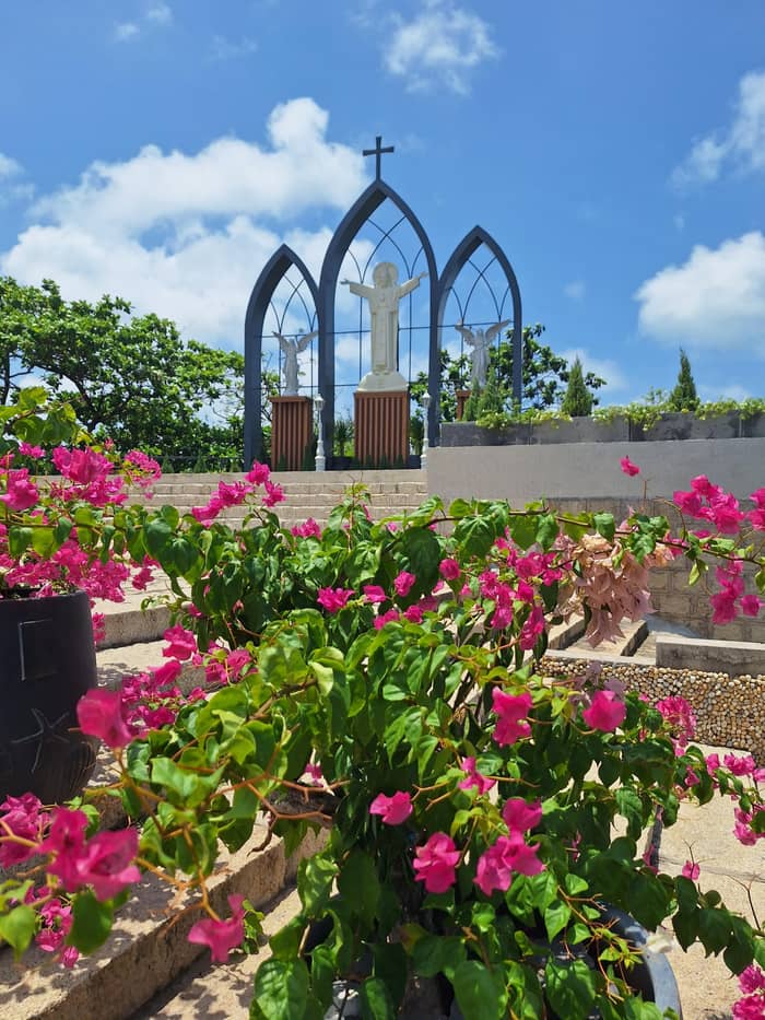
Group day
Our main day
Leisure time on Back Beach
- Duration12 hours
- Reviews386
- Beach1.5 hours
Locate your stop
Find out about 20 stops
Choose a route, then tap a pin or stop for its note and a Google Maps link.
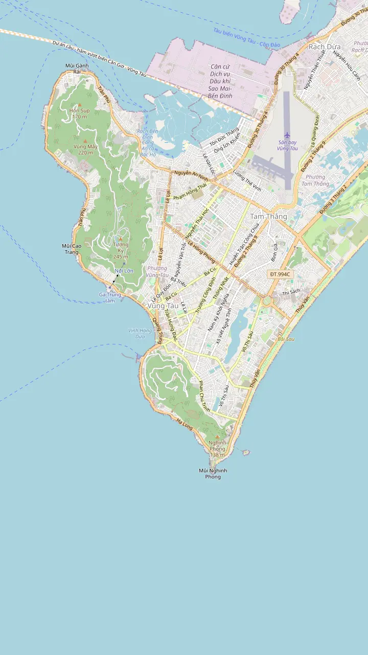
Back Beach (Bai Sau, Thuy Van) is the long beach with flat, safe waves, beach clubs and water sports.
Google MapsFront Beach (Bai Truoc) faces west, with nightlife in the evening and sunsets over the water.
Google MapsDau Beach (Pineapple Beach) has calm water and rocky outcrops.
Google MapsHon Ba is a miniature island off the end of Back Beach, reached only at low tide.
Google MapsNghinh Phong cape is the longest point in the south of the peninsula and catches the wind in all four seasons.
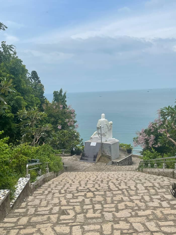
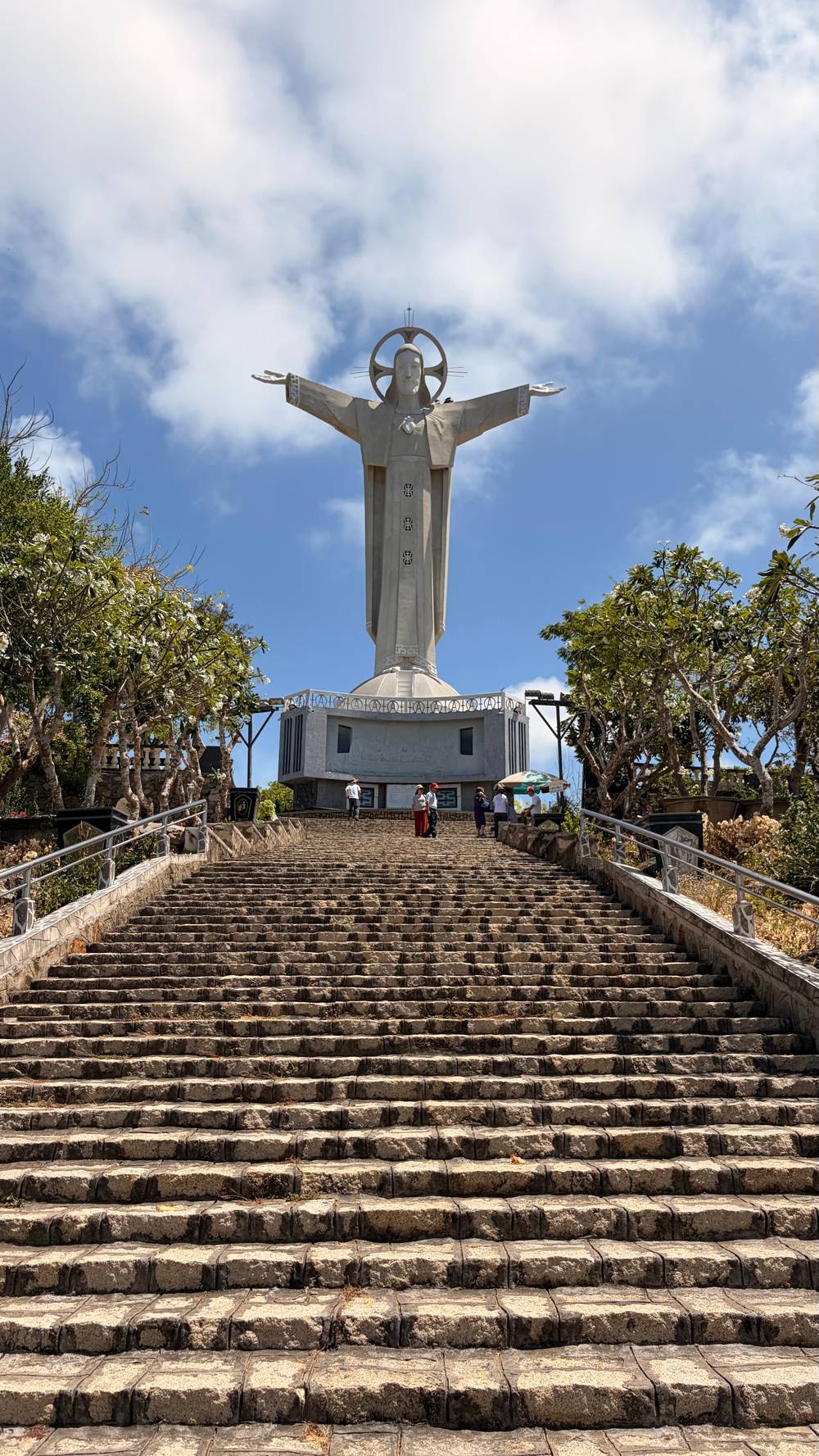
Google MapsThe Christ the King statue rises 32 metres on Little Mountain, reached by about 800 steps.
Google MapsThe lighthouse on Little Mountain has 360-degree views suited to sunset.
Google MapsBach Dinh, the White Palace, is a museum in a villa that dates to 1898.
Google MapsHo May Park sits at 210 metres and is reached by a 500-metre cable car.
Google Maps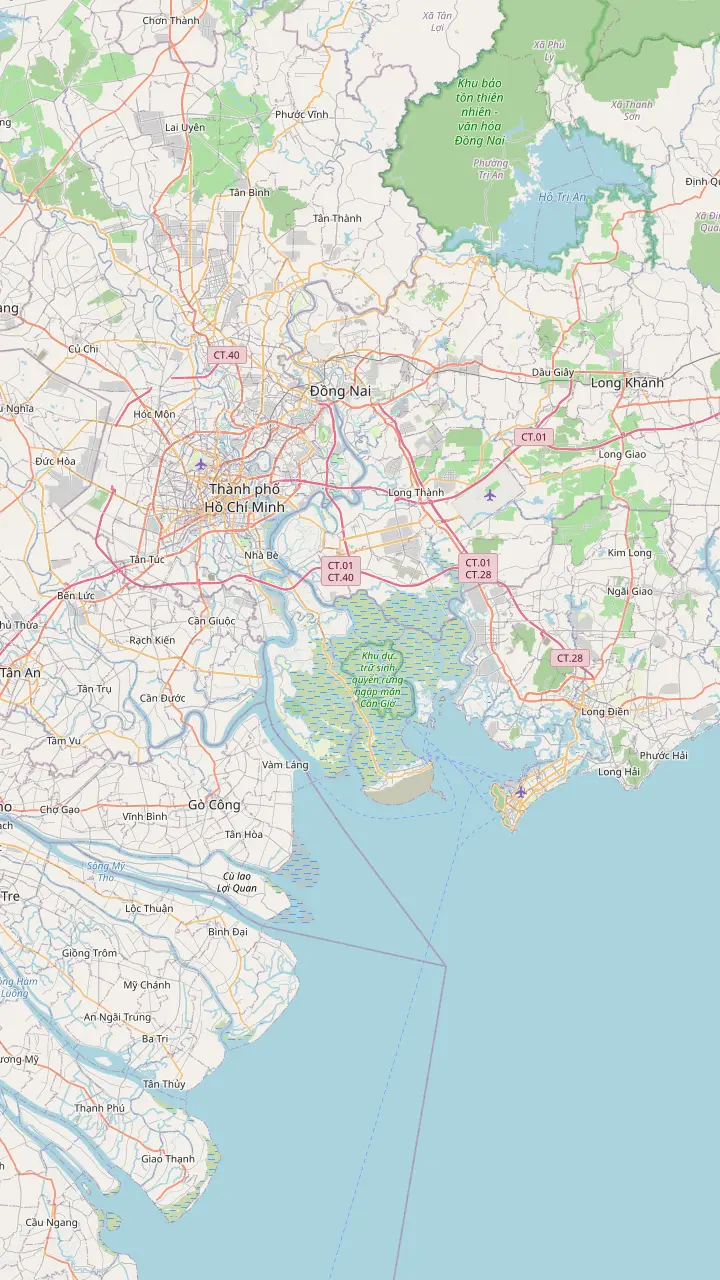
A central landmark of Ho Chi Minh City, drawn here to place the city against the coast.
Google MapsNha Rong Port in District 1 is where hydrofoil tickets and schedules are sold; the ride to Front Beach takes roughly 2 hours.
Google MapsThe main airport of Ho Chi Minh City, where many arrivals begin the trip to the coast.
Google MapsFront Beach (Bai Truoc) faces west, with nightlife in the evening and sunsets over the water.
Google MapsBack Beach (Bai Sau, Thuy Van) is the long beach with flat, safe waves, beach clubs and water sports.
Google Maps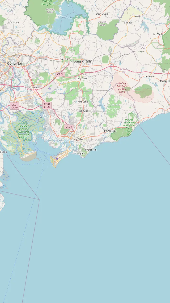
Front Beach (Bai Truoc) faces west, with nightlife in the evening and sunsets over the water.
Google MapsBack Beach (Bai Sau, Thuy Van) is the long beach with flat, safe waves, beach clubs and water sports.
Google MapsDau Beach (Pineapple Beach) has calm water and rocky outcrops.
Google MapsThich Ca Phat Dai is a hilltop Buddhist complex on Big Mountain with a giant seated Buddha.
Google MapsLong Hai beach is a stop for a quick dip on the way to the Monkey Temple.
Google MapsHo Tram has high-end beach resorts further along the coast, according to the family guide.
Google MapsMap data from © OpenStreetMap contributors
Where each stretch of sand sits on the peninsula, how the national tourism authority describes it, why the official figures for Back Beach disagree and what a day trip from Saigon really gives you.
Editorial team, vungtaudaytrip.quest · Updated November 16, 2026 · 7 mins to read
Key facts
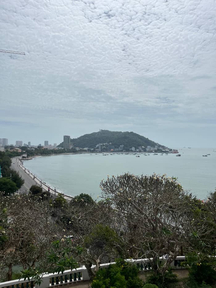
Back Beach in Vung Tau is the beach most visitors from Ho Chi Minh City picture when they say the city’s name. Its Vietnamese name is Bai Sau, and the same sand is also called Thuy Van Beach. The national tourism authority calls it the longest beach in the city.2 It faces the open sea on the southeastern flank of the peninsula, so the horizon is wide and the light is strong from mid-morning.
The water here is gentle. Vietnam Tourism says the waves on Back Beach are fairly flat and safe, which it presents as a reason to bring small children.1 The same page describes a strip lined with upscale hotels, restaurants and beach clubs, and local vendors who rent umbrellas on the sand.6 Water sports are part of the picture as well, with surfing, stand-up paddling and kite surfing named on the authority’s page.2 None of this replaces checking the sea on the day, but it sets the tone: a resort beach, not a wild one.
Behind the sand, a low hill gives a different view of the same coast. The Hill of Pigs stands right behind the sand, and in the news agency’s phrase it works as a natural beacon for the city.9 Off the end of the beach lies the little island of Hon Ba, which the authority says can be reached only at low tide.10 A morning walk along the shore, a swim and a look at the tide tables is a plan that fits a day with only a few hours of beach time.
The beaches side by side
| Beach | Where it is | What the sources say |
|---|---|---|
| Back Beach (Bai Sau) | Southeastern side7 | Flat waves, beach clubs, water sports1,2 |
| Front Beach (Bai Truoc) | West side4 | Nightlife and sunsets3,4 |
| Dau Beach | Not placed on a map in the sources5 | Calm water and rocky outcrops5 |
| Vong Nguyet and Huong Phong | Either side of Nghinh Phong cape12 | Windy bays for views rather than beach clubs12 |
The descriptions are the tourism authority’s and the news agency’s own; conditions change by season and tide.13
The official figures for the length of Back Beach do not agree, and that is worth knowing before you plan a long walk. The essential Vung Tau guide on the authority’s site describes a three kilometer-long strip of sand.6 Another article on the same site gives Back Beach, there called Thuy Van Beach, a run of nearly 10 kilometres down the city’s southeastern flank.7 A day-trip listing in our records repeats the nearly 10 km figure for the shore at Thuy Van.
We cannot tell you which stretch each figure measures, and it would be a guess to say. So whichever figure a guide gives you, ask which stretch it measures.
For planning, the difference changes little. Whatever the length, the arrival point of a day trip is a single area of the Bai Sau beach in Vung Tau, and most visitors stay within a short walk of it. If you plan to jog or walk the whole shore, take the longer figure seriously, carry water and allow time to come back. The city’s total coastline is about 42 km according to the authority, which puts the Back Beach figures in context.11
Front Beach, or Bai Truoc, sits on the opposite side of the peninsula from Back Beach. The authority says it is well known for its vibrant nightlife.3 Another Vietnam Tourism article gives its second name, Tam Duong Beach, places it on the west side and calls it the perfect spot to catch an ocean sunset.4 That west-facing position is the reason to plan a late afternoon or early evening here, when the day trip’s sightseeing is done.
The beach is also the doorstep of the city’s colonial sights. The White Palace stands on Tran Phu Street beside the provincial museum, in the account of the national authority.14 The villa and museum sit close to the Front Beach side, which suits a visitor who wants a swim and a museum on the same afternoon. The authority’s family guide even suggests ending a route on Front Beach at sunset, to watch the sky turn scarlet and purple.15
A seafront road runs the length of the peninsula and gives a gentle way to link the beaches. Vietnam Tourism describes a long, breezy road below the peaks, with wide pavements and a view of the mangroves and the ships that dot the shore.16 Walking part of it at the end of the day is a good alternative to another taxi. If you plan to eat in the evening, the night seafood market on Back Beach is covered on our page about food, and the beach hotels are listed on the planning page.
Pick your sand
Name what you want from the water and the matching stretch of coast appears.
If I want flat water for children
Back Beach
The authority calls the waves fairly flat and safe and suggests it for little ones.1
If I want a sunset and a drink
Front Beach
It faces west and the authority names it for sunsets and evening nightlife.4,3
If I want quiet and rocks to photograph
Dau Beach
The authority describes calm water and rocky outcrops.5
If I want to surf or paddle
Back Beach
The authority lists surfing, stand-up paddling and kite surfing there.2
If I want to swim on a day trip
Check the listing
One listing allows a swim and another says swimming is not available.
Day trips and beach plans
Group day
Leisure time on Back Beach
Swim
Relax or swim
Stroll
Walk, no swimming
Not every beach in Vung Tau is built for crowds. Vietnam Tourism says Dau Beach has calm waters and fascinating rocky outcrops.5 The authority lists the best-known beaches of the city as Pineapple, Vong Nguyet, Front and Back.13 If the long beaches feel busy, Dau is the beach to ask your driver about, since its rocks make it a place for photographs and a quiet dip rather than for beach clubs.
The southern tip of the peninsula has its own set of bays. The Vietnam News Agency calls Nghinh Phong cape the longest point reaching out at the southern end of the peninsula, a name that refers to the wind it receives in all four seasons.12 The same account says the cape forms the bays of Vong Nguyet and Huong Phong. For a visitor this means that the scenery south of the statue is windy and open, a place to look at the sea more than to swim in it.
Some small coastal curiosities complete the list. Ben Dinh is a fishing village where, according to the authority, the catch is hauled in before sunrise and sorted on the sand, with brightly coloured boats moored by the beach.26 And Hon Ba, the little island, carries a temple that the authority says can be reached by boat or on foot over a revealed rock path at low tide.27 Both are better as a morning stop than as a swimming plan, and neither is on the usual day-trip route.
Price the day
Enter your party to see what the group days with beach time start at.
Look at 3 options
Enter your party to see what the group days with beach time start at.
≈
View≈
View≈
ViewStarting prices from GetYourGuide, converted at the ECB reference rate. You will see the exact price when booking.
A beach day in order
07:00
One listing in our records starts with pickup between 07:00 and 07:30 in District 1.
07:30
The main listing’s group leaves Ho Chi Minh City at this hour for the coast.
09:00
Another listing gives arrival in Vung Tau and beach time starting at 09:00.
12:00
The listings place lunch at a local restaurant around midday.
Afternoon
The statue, whale temple, White Palace and Nghinh Phong cape follow.
18:00
Per the main listing, the drive home ends near 18:00, and traffic and weather can move it.
The day trips that sell Vung Tau as a beach day do not all treat swimming the same way, so read the one you book. Our site’s main listing is a full-day group trip of 12 hours with leisure time at Thuy Van Beach, a lunch at a local restaurant, the statue, the whale temple and the White Palace, and it starts from $28. The record gives Thuy Van Beach about 1.5 hours with swimming, enough for a dip and a walk.
Another listing in our records says plainly that guests can relax or swim at Thuy Van Beach and should bring a swimsuit, with arrival in Vung Tau at 09:00 and lunch at 12:00. A further listing, which starts with the statue, says that swimming at the beach is not available on that tour and offers a walk along Back Beach at 11:00 instead. The same day trip may therefore suit a swimmer or a stroller, depending on the operator, and the booking page is the place to check.
Whatever the listing, the sea can be unpredictable. A listing itself warns that the time you return depends on traffic and weather. The authority describes the waves of Back Beach as fairly flat and safe, which is a statement about the beach and not a guarantee for any given day.1 Wear what you can swim in under your clothes if you intend to get wet, keep valuables with the guide and remember that the statue visit later in the day has its own dress rules.
Video
Ayngelina on YouTube · Video data is requested only when you tap play.
The waves on Back Beach are fairly flat and safe, so it’s a great place to bring little ones.
Before you go
Vung Tau has a rainy season and a sunny one, a pattern Vietnam Tourism ties to its tropical monsoon climate while still calling the city a year-round destination.28 On timing, the family guide is more precise, putting the best weather between November and April and calling December and January the breeziest and most pleasant weeks.8 Those are the months to choose if the beach is the point of the trip.
Outside the dry season the day can still work, with some planning. A day trip leaves Saigon around 07:30 in the morning and returns around 18:00 according to the main listing, which leaves many hours of daylight at the coast even when clouds build in the afternoon. Put the beach early and the temple and palace later, as the listings do, so that a late shower costs you indoor sightseeing time and not the swim. Check the forecast before you book and keep your plans light.
A beach day from the city is also a distance question. The authority puts Vung Tau about 100 km from Ho Chi Minh City and calls it a popular getaway for the city’s residents.29 That makes a full day of sand and sights realistic without a hotel, and our page on getting to Vung Tau compares the road, the ferry and the tour. If you want the sunset side of the peninsula, spend the night; a day trip that returns in the early evening will miss the light on Front Beach.
FAQ
One listing allows a swim at Thuy Van, another says swimming is not available, so check yours.
The authority calls Front Beach (Tam Duong) the perfect spot for an ocean sunset.4
The family guide gives November to April as the dry season, with December and January the most pleasant.8
The authority puts the city about 100 km from Ho Chi Minh City.29
Sources
Planning a Vung Tau day from Ho Chi Minh City? Ask a real person here.